
Member of WMO-CGMS Virtual Laboratory For Education And Training In Satellite Meteorology
a global network of specialized training centres collaborating with satellite operators
The History of Satellite Applications Training at IMTR-Nairobi
Weather analysis relies heavily on the availability of accurate observation data. For meteorologists to draw meaningful conclusions, they must be well-trained in various meteorological data types and be proficient in using diverse data-processing methods. In Africa, there has long been a pressing need to develop a critical mass of skilled meteorologists capable of analyzing and interpreting weather data at a level comparable to that of developed countries. To meet this demand, capacity development in Satellite applications has become a central objective for meteorological personnel across the African continent.
However, the challenge of training in satellite data processing has been significant. Many African countries lack the necessary infrastructure, equipment, and resources to provide this specialized training or to apply satellite data effectively across various sectors of economic development.
To address this gap, international cooperation and bilateral agreements have played a crucial role. Organizations such as the U.S. National Oceanic and Atmospheric Administration (NOAA), the European Organisation for the Exploitation of Meteorological Satellites (EUMETSAT), and the World Meteorological Organization (WMO) partnered with IMTR to offer sponsored satellite applications training at Regional Training Centres across Africa. Due to technological limitations, these training sessions were initially conducted face-to-face, with countries sending one or two representatives at a time to attend workshops and training courses.
In 1987-1989, the University Corporation for Atmospheric Research (UCAR)—a consortium of universities focused on atmospheric research—established the Meteorological Education and Training (COMET) division. IMTR-Nairobi was identified as a key partner, receiving training materials on compact discs (CDs) with a diameter of 30 cm, similar to vinyl records. This early technology, however, was not sustainable due to limited production, unreliable hardware, and the inadequate computing power at IMTR at the time.
With the introduction of Windows 95 in 1993, IMTR was able to upgrade its systems and begin training on Windows-based applications. This upgrade also allowed the National Meteorological Center in Nairobi to use a French weather processing system called Synergie, which enabled access to satellite data from the Meteosat satellite. The Meteosat data provided critical information across three channels: visible, water vapor, and infrared.
In 1997, the African Satellite Meteorology Education and Training (ASMET) project was launched collaboratively by EUMETSAT, WMO, and COMET. The initiative aimed to improve the accessibility of satellite data and enhance the capacity to process, analyze, and apply this data in weather forecasting. By improving the quality of forecasts across Africa, the ASMET project became a pivotal part of the continent's meteorological development. The project produced training materials in CD format and online, addressing the significant data gaps that existed due to limited ground-based observations in many African countries.
The ASMET project began by training trainers, which allowed for the development of specialized training materials on topics such as: The Fundamental Principles of Remote Sensing, Understanding Indian Ocean Tropical Cyclones, Continental Droughts and Floods, The Development of Easterly Waves and Their Effects on Squall Lines in West Africa, Nowcasting Using Satellite Data etc.
By 2010, with support and in collaboration with EUMETSAT, IMTR-Nairobi was able to offer both face-to-face and virtual training courses in Satellite application. As internet access became more widespread across Africa, this online training approach helped accommodate more than 80 participants simultaneously, overcoming the financial and logistical challenges that had limited face-to-face participation.
Between 1998 and 2024, more than 15 satellite training modules have been developed, all of which are available on the ASMET website.
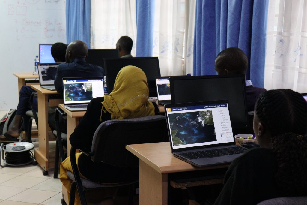
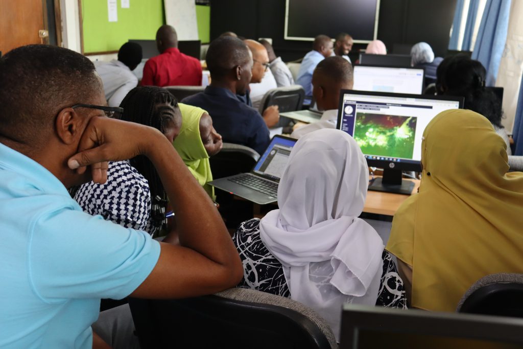
At IMTR-Nairobi, we conduct courses that integrate satellite meteorology with practical applications. Our ASMET and PUMA laboratories are equipped with the necessary hardware and software for receiving and analyzing and visualising satellite data.
The ASMET (African Satellite Meteorology Education and Training)
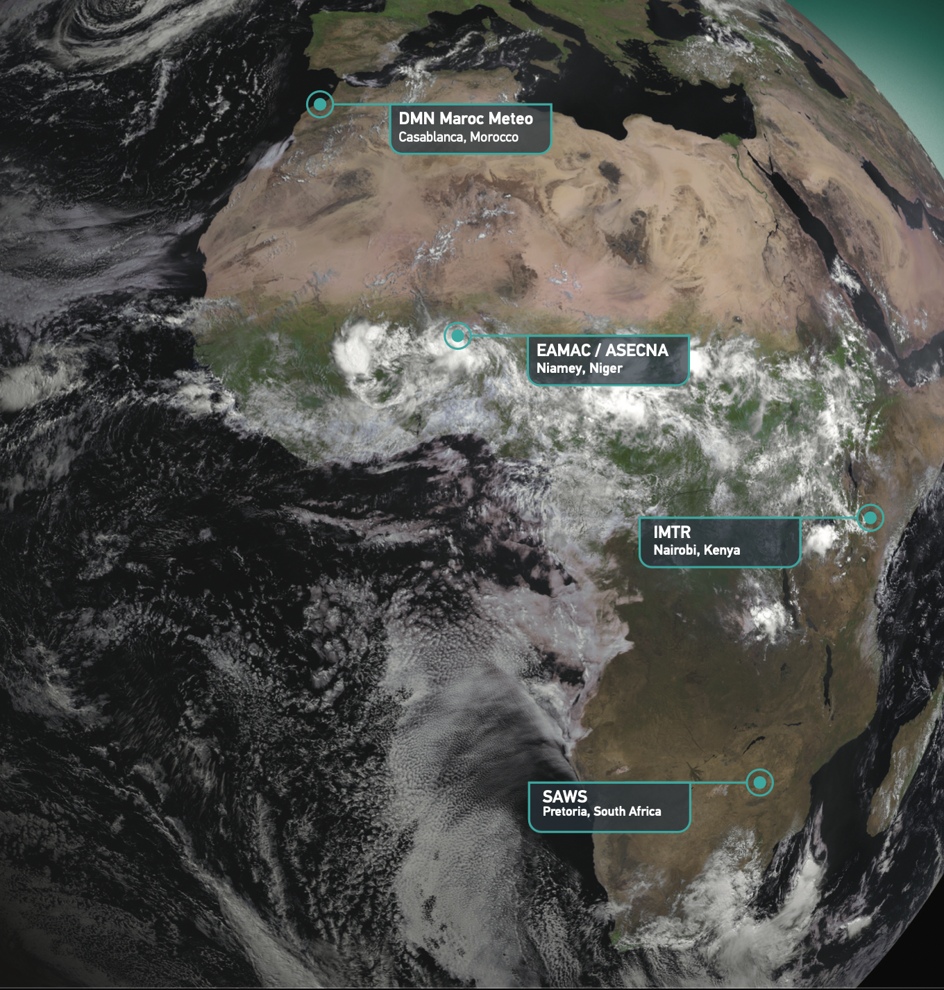
The ASMET, the African Satellite Meteorology Education and Training project is supported by meteorology instructors from the:
- South African Weather Service (South Africa)
- Institute for Meteorological Training and Research (Kenya)
- EAMAC/ASECNA (Niger)
- Morocco National Meteorology Department or DNM (Morocco)
- EUMETSAT (Germany) and
- The COMET® Program (USA).
- Interpretation of significant meteorological phenomena by use of conceptual models.
- Use of NWP products and be aware of the strengths and weaknesses of NWP products.
- Verification of forecast products against observations, measurements and meteorological satellites products.
- The use of meteorological satellite data including RGBs and how to interpret them and apply them in analysis of various synoptic and mesoscale weather phenomena.
- Blending meteorological satellite data and products with NWP products in the Nowcasting process.